It’s Sky Time
Jamestown and the Atlantic Crossing
When Sue and I moved aboard our catamaran, ‘Surprise’, in 2008, one of our first destinations was Jamestown, Virginia. I wanted to sail up the James River at the SW corner of Chesapeake Bay as 104 English men and boys had done 401 years prior to found the first permanent English settlement in North America.
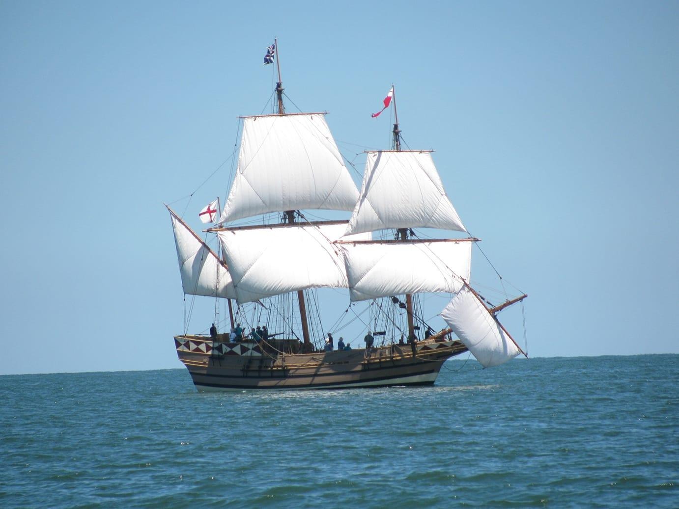
‘Godspeed’, one of three vessels which brought the Jamestown colonists from England.
We came in off the ocean through the Virginia Capes, Charles and Henry, named for King James I’s two sons. Crossing Chesapeake Bay, we entered the river against an adverse tide and realized that progress under a fickle wind was impossible. Anchoring and awaiting a fair tide as the first arrivals had done, we then made our way 30 miles upriver to a low, poorly drained shore. Fresh water proved brackish and poor tasting, Mosquitos were ever-present and the uninhabited site apparently had proved of no value to the local Powhatan Indian tribe.
We anchored bow and stern in the fast moving current and dinghied ashore. After his astonishment at watching us climb the riverbank, arriving by water not the parking lot, we were met by a fellow in one of those funny hats: a National Park ranger. My first question, “Why in God’s name did these poor souls pick such an inhospitable site so far inland from the sea to settle?” “Ah.” he replied, “So what happened just south of here at the Outer Banks 20 years earlier?” “Oh yes,” I remembered, “the Roanoke Colony had been lost.” He continued, “No one knew why that first English settlement in 1587 had mysteriously disappeared with only the word “CROATOAN” found carved in the palisade wall. Could have been Indians, could have been the Spanish. The Jamestown settlers wanted to be far enough inland to not be found.”
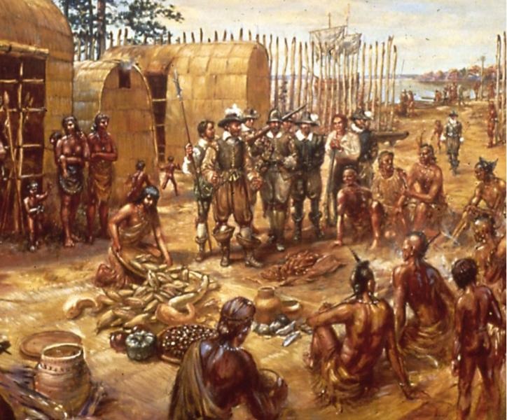
Jamestown faired poorly. The Powhatans, though originally accommodating and offering food to the English, quickly felt taken advantage of and ended relations. The winter of 1609-10 became “The Starving Time” when the inhabitants, afraid to leave the fort, reverted to eating all they had, including each other – A fact only recently discovered by ongoing archeology digs and blade marks found on exhumed limb and skull bones of the residents. Sue tells me Jimsonweed, aka ‘Thorn Apple’, is so named from its discovery at Jamestown, and that its known hallucinogenic characteristics only enhanced the madness occurring as the souls succumbed to death.
By 1610 75% of the population were gone from starvation and disease; bad water took its toll. Although two ships arrived having been ship-wrecked and delayed in Bermuda, one carrying John Rolfe who will introduce tobacco to Virginia and marry Pocahontas, on June 8 the decision is made to abandon Jamestown. Heading down the James River on their planned return to England, the departing colonists meet the resupply vessels led by Lord De La Warr who demands all return to Jamestown. And so the vagaries of history take over. How remarkable supplies arrive and ships cross paths – one leaving for sea, the other coming upstream on the very same day on the river below Jamestown. The settlement survives.
More than 100 years later Ben Franklin crossed the Atlantic Ocean eight times during his lifetime, a crossing that took between 6 weeks and 3 months. The sail west to North America from England is upwind and on his first westward crossing in 1726 Franklin’s ship did not lose sight of the English coast for 20 days. Leaving in July, he arrived in Philadelphia in October. Franklin with his keen mind, interest in natural science and much time walking the ship’s deck with thermometer in hand, plotted much of the Gulf Stream.
So how does a sailing ship leave England and arrive at the Virginia Capes two months later?
No Loran, no GPS, only primitive compass, sextant, wind maps, current maps - later helped by Franklin. Captains knew to sail West; the compass and the setting sun helping arrival from Europe on North America’s eastern shore. But if you sail south from England, when do you turn Right? As over millennia, stars had the answer, and one was marvelously positioned.
Perhaps the most famous in the Northern Hemisphere: Polaris, the North Star.
Polaris’s celestial position sits directly over the North Pole. If you run a rod from the Earth’s center through the North Pole and extend it skyward, you will hit Polaris. If you are at the Equator, zero degrees of Latitude, the North Star is found on the horizon to the north at an angle of 0 degrees, appearing to lay on the land. If you are at the North Pole, at 90 degrees of earthbound Latitude, the North Star is directly overhead at the zenith, also 90 degrees.
This is called the ‘Altitude of Polaris’ and it tells us then that whatever Latitude you are at in the Northern Hemisphere, when you ‘shoot’ Polaris, this is the same angle you’ll derive on your sextant, a mariner’s instrument to measure angles. If you live in Connecticut at 41 degrees North Latitude or in south Florida at 27 degrees North Latitude, then when you arrive on your front lawn at dusk or dawn and can see both the horizon and the North Star simultaneously, the measurement or altitude from the horizon to Polaris will be either 41 or 27 degrees.
So back to our sailing ships of the 17th century. Sailing south from England, turn Right somewhere off Gibraltar. Lord De La Warr’s predecessor determined the Virginia Capes lay at 37 degrees N. So set your sextant at 37 degrees. When your sextant finds Polaris at a greater angle than 37 degrees off the horizon you are too far North, the star is too high, so sail South. When the angle to the star is less than 37 degrees, star too low, sail North. Keep West. You won’t know how far across the Atlantic you’ve come – your position of Longitude was solved later with the chronograph. But sometime between 6 weeks and 3 months you’ll hit North America at Virginia’s Capes.
Bring food….
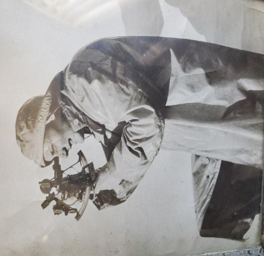
Sextant to his eye, my
Grandfather, Pete Rowland, author and explorer, off The Labrador, 1906.
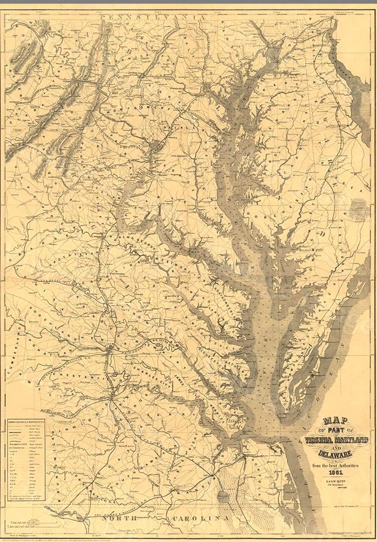
An early engraving of Chesapeake Bay. At 37 degrees North Latitude,
Cape Charles and Cape Henry are at lower right.
Leading from the Bay, the James River sits due west.
Up the river 30 miles (at the upside-down U) sits Jamestown on the north shore.
This picture shows the spidery tendrils of the Bay’s tributaries as they now appear. Virginia’s tidewater was flooded out when the ancestral Susquehanna River overflowed with rising sea water eons ago.